
Railway history in the Ottawa and St. Lawrence valleys started in the 1850s, when the technology was brand new. For almost seventy years the network grew, driven by local ambitions and national dreams. When it reached maturity, about a century ago, the region had been transformed, socially and economically. Railways continued to be vital through the twentieth century. Even now, we live in the world they shaped and continue to serve.
Tracing the Lines tells their story. In text and through 29 specially-created maps, Tracing the Lines explains the evolution of the regional rail network and shows the contributions of dozens of independent ventures to our railway history.
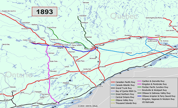
Over time the many small railways were absorbed into larger and larger enterprises. By 1923 almost everything belonged to either Canadian National or Canadian Pacific. Their duopoly lasted, periodically closing unprofitable lines, into the 1990s. Then they sold off routes to new entrants, including VIA Rail Canada and various short line freight operators. In this century the network has contracted sharply. The maps in Tracing the Lines let you see the process unfold.
Format
Tracing the Lines is a 55-page ebook in .PDF format. It is a 17 MB download. The ebook is readable on your device of choice and printable on legal size (8.5″ X 14″) paper. You can print individual high resolution ( 4200 x 2550 px) maps.
Updates
I update Tracing the Lines as needed to reflect changes in the rail network and new research findings. The January 2020 version is the most recent.